
Columbus Landing Beach
BeachesSt. CroixCane Bay and the North ShoreLast verified October 31, 2026
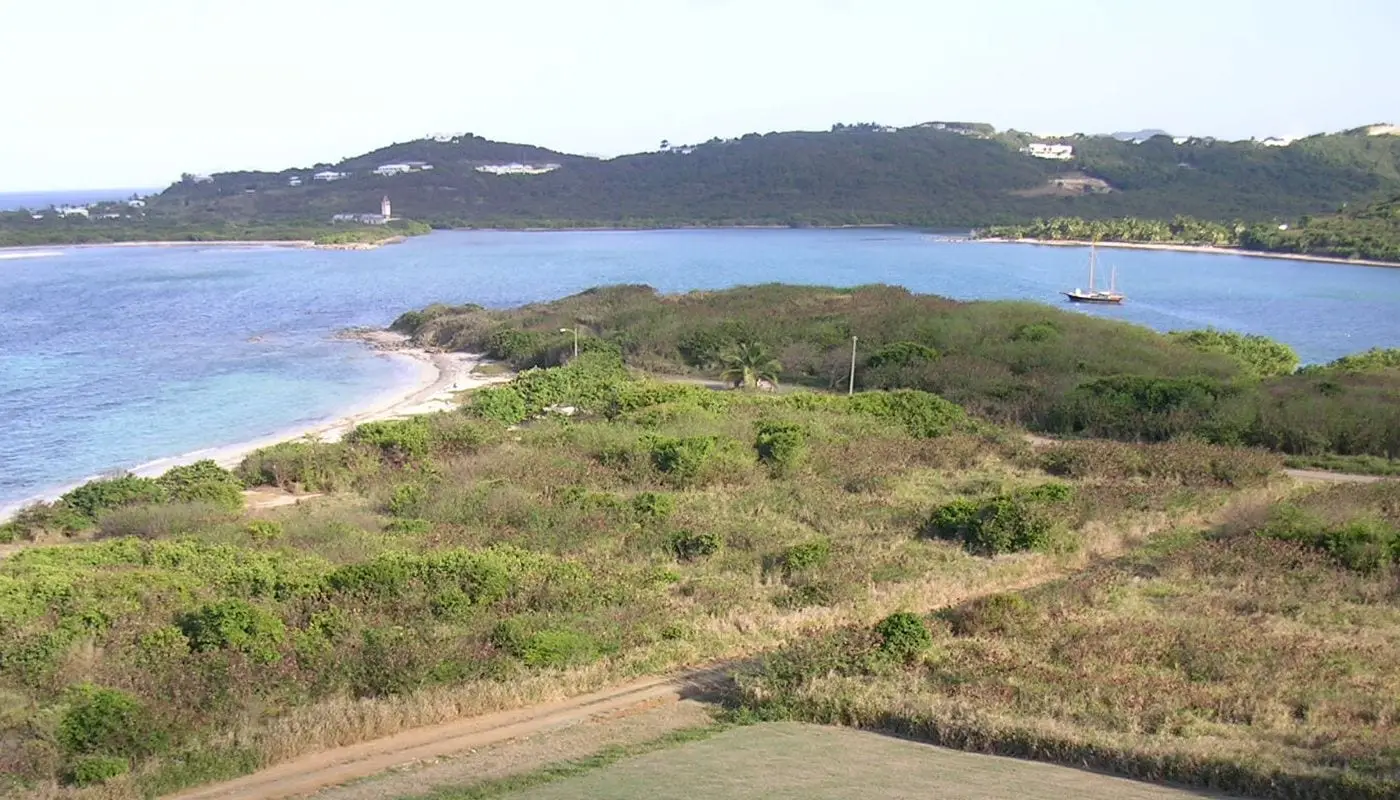
Photo: Eoghanacht, Public domain

Columbus Landing Beach is on Salt River Bay on St. Croix's North Shore, in Salt River Bay National Historical Park and Ecological Preserve, co-managed by the National Park Service and the Department of Planning and Natural Resources (DPNR). A Native village stood here in the 1400s, and the site is known for the 1493 encounter with Columbus's crew. From Christiansted, take Northside Road west, turn right onto North Shore Road (Route 80) and drive past the Salt River Marina entrance to the road's end. It is usually quiet, with no facilities and little shade. The water suits swimming over a mostly grassy bottom, with a reef offshore for snorkeling; the park warns of hazardous surf and crosscurrents, so do not swim alone. The preserve is day use only; digging, littering and temporary structures are banned. DPNR listed the beach as not monitored this season in its October 30, 2026 data.
Services
- No facilities; little shade
- Swimming, with a reef offshore for snorkeling
- Day use only
- Kayak tours from nearby Salt River Marina
How we checked
Last verified on October 31, 2026. We checked it against the sources below.
Source: GoToStCroix, https://www.gotostcroix.com/discover/parks-recreation/columbus-landing/ (co-management with DPNR and the National Park Service, directions, quiet beach, Native village in the 1400s and the 1493 encounter, swimming, grassy bottom with sandy patches, reef a short way out, no amenities, little shade, day use only, banned activities) and https://www.gotostcroix.com/discover/beaches/salt-river/ (a second beach just around the point, reached through Salt River Marina, where many kayak tours come and go), both copyright 2026; National Park Service, https://www.nps.gov/sari/planyourvisit/basicinfo.htm (joint management, 1493 encounter, hazardous surf and crosscurrents, do not swim alone), https://www.nps.gov/sari/planyourvisit/directions.htm (Route 75 to Route 80; co-managed with DPNR) and https://www.nps.gov/sari/planyourvisit/hours.htm (updated February 19, 2026); DPNR beach data, https://dpnr.vi.gov/beach-advisory/ (Columbus Landing is marked as not monitored this season in the data sheet of October 30, 2026); all accessed 2026-10-31. No source states lifeguard coverage, so none is claimed. Map point: GNIS feature 1993647 (Beach), 'Salt River Beach'; DPNR's Columbus Landing monitoring site (STX-18, https://www.waterqualitydata.us/provider/STORET/USVIST_WQX/USVIST_WQX-STX-18/, accessed 2026-10-31) lies about 175 meters away. GoToStCroix's separate Salt River beach is covered here.
USVI Realty does not rank, rate or endorse the places and services in this directory. Hours, fees and rules change, so check the official source before you go.
Around Cane Bay and the North Shore
Photo: Андрей Бобровский, CC BY 3.0

Photo: CaptJayRuffins, CC BY-SA 4.0

Photo: Kborer, Public domain
